


Description

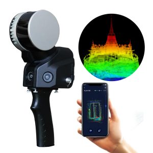
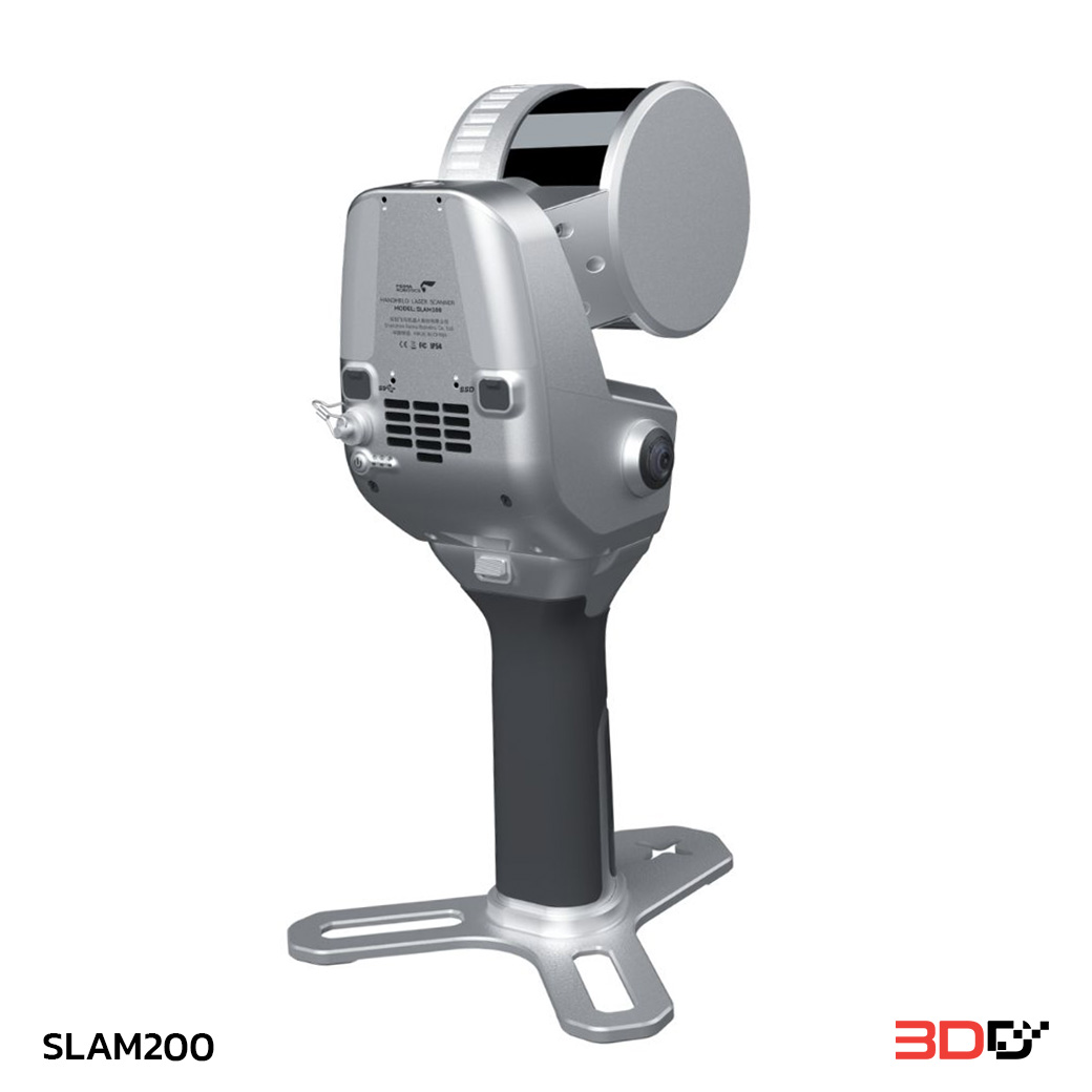
SLAM200 is the third generation high-precision handheld laser scanner. SLAM200 LiDAR Scanner features a panoramic camera, a higher-performance laser sensor, built-in GNSS module and a more powerful processing unit, offering higher precision, finer details, and more convenient functions. SLAM200 handheld Lidar Scanner is a more efficient and convenient measurement tool to obtain high-precision 3D point cloud data of the surrounding environment.
Features:
High Precision, High Density
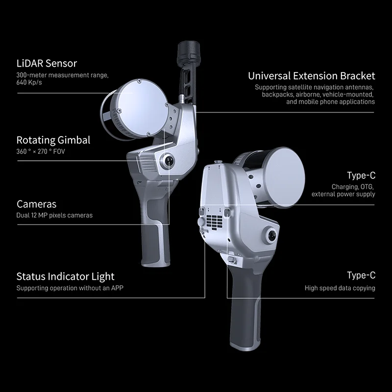
High-performance laser sensor with 640 kpts/s laser pulse repetition rate and smaller laser spot; SLAM algorithm, it can achieve high-precision, high-density and high-fineness point clouds.
Built-in GNSS Module
SLAM200 has a built-in GNSS module and can connect to the CORS system via a mobile phone, providing absolute position of the data.
Longer Measurement Range
A longer measurement range allows SLAM200 to take into account both ground mobile measurement and airborne data acquisition.
Real-time Mapping
Real-time SLAM can fullfit real-time mapping, real-time coloring, real-time orientation by RTK data.
Panoramic Camera
Dual 12MP fisheye cameras can generate panoramas, color point clouds, and for visual SLAM mapping.
Multi-platform Mounting
SLAM200 supports multi-platform operations, including handheld, backpack, vehicle-mounted and drone.
Your Purchase Includes:
1x SLAM200 Handheld LiDAR Scanner
1x Accessories Package